From 1689:
1689 Cossaks state after Bohdan Khmelnystky’s death is conquered by Moskovia and Ukraine is divided between Poland and Moskovia. Look on Crimean Khanate
Lithuania includes such Western Ukrainian lands as Volinia, Podolia (now – Khmelnytsky and Vinnytsya regions) and Russia (!!!) = Halicia. Halychyna in XV-XVIII was marked on many maps as Russia or Red Russia (Червона Русь) and people of this lands called themselves as русини rusyny
Scotland and Ireland are still independent.
Transylvania is independent state Moldova, Romania, Walachia, Bulgaria and Serbia are united in one state or union.
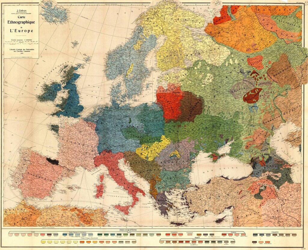
This is an ethnographic map of Europe from 1918 (printed in France).
You can see Ukrainians far on East and North-East – now Russian regions of Kursk and Voronezh, and Kuban and Don regions on South-East near Caucasus.
You might have heard that Kubal and Don were settled by kossaks after Sich was destroyed in 1775. Kyrylo-Mefoddivske bratstvo (brotherhood) of which Taras Shevchenko was a member believed that in future Don and Kuban will be Ukrainian states or autonomous regions of Ukraine.
Various ethnic groups and nations on Russian territory are marked and map is incorrect about Western Ukrainians on Polish and Slovakian territory (Lemky is the most significant group).
Basques and Catalans are there on the map.


